 Stuarts Draft, États-Unis (USA) Augusta County, Virginia
Quelle heure est-il?
Heure actuelleStuarts Draft États-Unis (USA)
Quel jour est-il à Stuarts Draft en ce moment ?
Mardi (22/04/2025)
Eastern Daylight Time (North America)EDT
Fuseau horaire | America/ New_York |
Temps universel coordonné GMT / UTC | UTC-5 |
Heure d'été EDT: Eastern Daylight Time (North America)En cours d'utilisation | UTC-4 |
Temps standard EST: Eastern Standard Time (North America) | UTC-5 |
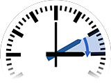
Dernier changement d'horloge
à Heure d'été

Dimanche, 09/03/2025
1 heure adelante
de 02h00 à 03h00
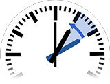
Prochain changement
à Temps standard

Dimanche, 02/11/2025
1 heure dos
de 02h00 à 01h00

Calculatrice décalage horaire
Comparez l'heure locale de deux fuseaux horaires, pays ou villes du monde.
Stuarts Draft
Le soleil à Stuarts Draft:
Hoy en día, 22/04/2025

Lever du soleil
06h30
Heure locale
Coucher de soleil
19h58
Heure localeRenseignements auprés de la ville
Noms alternatifs
- Stewarts Draft
- Stuart's Draft
- Stuarts Draft
Pays
Stuarts Draft est une ville en/au/aux États-Unis (USA).
Fuseau horaire
Le nom du fuseau horaire est America/New_York.
Population
9 235 Habitants
Altitude
433m
Villes autour Stuarts Draft (Augusta County, Virginia)
Washington ... 186 km
Greensboro ... 224 km
Durham ... 225 km
Baltimore ... 239 km
West Raleigh ... 249 km
Raleigh ... 251 km
Pittsburgh ... 277 km
Virginia Beach ... 277 km
Ironville ... 297 km
Meads ... 298 km
Charlotte ... 341 km
Philadelphia ... 375 km
Columbus ... 382 km
Lexington-Fayette ... 434 km
Cleveland ... 438 km
Cincinnati ... 455 km
Staten Island ... 481 km
Newark ... 490 km
Jersey City ... 496 km
Brooklyn ... 499 km
New York City ... 499 km
Manhattan ... 507 km
Queens ... 508 km
The Bronx ... 517 km
Buffalo ... 535 km
Toledo ... 540 km
Windsor ... 568 km
Detroit ... 572 km
London ... 573 km
Hamilton ... 578 km
Fishersville ... 10 km
Waynesboro ... 13 km
Staunton ... 14 km
Crozet ... 27 km
Bridgewater ... 39 km
Buena Vista ... 42 km
Lexington ... 43 km
Charlottesville ... 45 km
Harrisonburg ... 48 km
Hollymead ... 49 km
Lake Monticello ... 58 km
Madison Heights ... 67 km
Lynchburg ... 69 km
West Lynchburg ... 70 km
Forest ... 77 km
Timberlake ... 81 km
Covington ... 82 km
Bedford ... 86 km
Farmville ... 96 km
Culpeper ... 97 km
Woodstock ... 103 km
Hollins ... 106 km
Vinton ... 108 km
Roanoke ... 111 km
Salem ... 116 km
Cave Spring ... 119 km
Elkins ... 119 km
Strasburg ... 119 km
Front Royal ... 119 km
Wyndham ... 120 km
Short Pump ... 122 km
Warrenton ... 125 km
Woodlake ... 128 km
Tuckahoe ... 128 km
Ashland ... 128 km
Glen Allen ... 129 km
Brandermill ... 129 km
Laurel ... 130 km
Fredericksburg ... 130 km
Bon Air ... 131 km
Dumbarton ... 132 km
New Baltimore ... 133 km
Lakeside ... 133 km
Chamberlayne ... 136 km
Richmond ... 137 km
East Highland Park ... 140 km
Aquia Harbour ... 140 km
Meadowbrook ... 141 km
Mechanicsville ... 141 km
Blacksburg ... 142 km